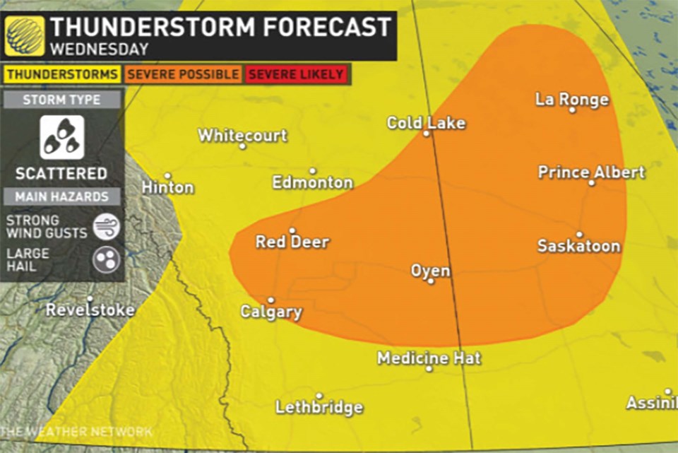
Airdrie and north Rocky View County residents may want to batten down the hatches in light of a storm risk warning July 13 for the northern prairie regions, including Calgary and areas north along the QE2 toward Red Deer, according to The Weather Network.
A storm track is developing across the north and allowing storms to move through the region this week, including Alberta and Saskatchewan amid extreme heat felt through the region.
"With the hot temperatures present, there will be a bit of a cap to contend with, however, the cold front should provide enough lift for some storms to break through that cap late afternoon and continue into the evening," wrote Kelly Sonnenburg, a meteorologist at The Weather Network.
The Weather Network's website states the main areas of concern will be near Calgary and north along the QE2 towards Red Deer through the late afternoon. Storms that develop will track east into the evening, advancing towards the provincial border.
"Strong to locally damaging wind gusts would be the main threat along with large hail that could reach up to golf ball-sized in some of the strongest storms," Sonnenburg added. "Supercells and rotating storms are also possible and most likely in the regions east of Red Deer and Calgary.
"If storms begin to rotate we will need to keep an eye on the tornado threat."
The release stated heat felt throughout the region is fuel for thunderstorms Wednesday afternoon and evening.
"A jet stream will be parked in a southwest to northeast orientation across Alberta helping to enhance rising motion in the atmosphere," it continued. "Hot, unstable air will be present at the surface and a cold front will be the main trigger to promote the storm initiation."
For additional updates regarding weather events in the region, visit weathernetwork.com


