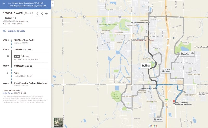
Riders of Airdrie Transit can now use Google Maps to plan their route, according to Transit Co-ordinator Chris MacIsaac.
“All the customer needs to know is where they’re starting their trip and where they’re going to. Google will do everything in between, including how long it’s going to take to walk to your bus stop, how long you’re going to have to wait for your bus and then how far you’re going to have to walk from where the bus drops you off,” MacIsaac said.
Before Airdrie Transit added its information to Google Maps, MacIsaac said it could be difficult for users to shuffle between multiple hard copy schedules and route maps or between multiple screens on its website.
MacIsaac said riders can still use Airdrie Transit’s TransLoc app to get real-time information about their buses.
“To us it was a no-brainer to provide this service in addition to our real time app. We’re certainly still supporting that,” he said.
“Google Maps (shows) what the trip planning would look like – we don’t have it in real-time at this point.
“The intent is to provide Google Maps with that real time information – so the information you’re getting on our TransLoc app would be the same information you’re getting on Google Maps.”
Getting Airdrie Transit’s routes and schedules on Google Maps took about three months to accomplish and cost the City nothing, according to MacIsaac.
“It’s a bit of a process because Google wants to ensure the data you’re providing is verified,” he said. “Google sees this as another avenue to get traffic to use their site so they don’t charge any of the transit agencies for providing that information.”
One downside is that Airdrie Transit has no way of knowing how many people will utilize Google Maps to plan their trips, according to MacIsaac.
He said now that the data is verified, it can be provided via open source.
“If there are interested application developers in the city, that information is now available as a public document, as open source data,” he said. “They can go and use (it) to build their own transit app if they wanted to.”


