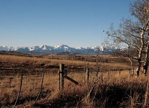
Work on an extensive study looking at the impact human activities have on Alberta’s southwest Foothills is once again underway after being on hold for almost four years.
A meeting was held at the MD of Ranchlands office at the Chain Lakes on March 25 to restart the third phase of the extensive Southern Foothills Study (SFS).
The meeting brought together many of the study’s original advisory group members as well as new members to decide which direction the project should now proceed.
Alan Gardner, executive director of the Southern Alberta Land Trust Society (SALTS), said it’s hoped the study will guide new approaches to development and land use in the sensitive foothills.
“Everybody knows that we need some rules, better than what’s happened before,” he said.
Gardner said they want the foothills study to complement the South Saskatchewan Regional Plan (SSRP), which is currently being developed by the provincial government.
“We would like to be, if you want to call it, partners in developing the SSRP plan in the area as maybe a sub-regional plan,” he said.
According to Gardner, the SFS was, in many ways, a precursor to the Land Use Framework and one of its strengths is the grassroots approach the project as taken. As well, he said the groups participating in the study have also been involved with the creation of the Land Use Framework and SSRP in some way or another.
An advisory group comprised of ranchers, municipalities, landowner groups and energy industry representatives was formed five years ago to initiate the SFS and SALTS hired ecologist Brad Stelfox to lead the project.
“There was a need five years ago for an organization to help co-ordinate this kind of thing,” he said.
In the study’s first phase Stelfox created a computer model called the Alberta Landscape Cumulative Effects Simulator (ALCES) representing the human footprint on the landscape of the southwest Alberta Foothills. The model looked at the impact human activities had on the environment including wildlife and water quality and quantity if development in the area proceeded on a ‘business as usual’ scale.
Gardner said the ALCES model showed a decline in quality of the various indicators of about one to two per cent a year.
“In the short term, that isn’t a big deal, but in the long term if that continued that was going to be a problem,” he said.
The project’s second phase was dedicated to publicizing the results of the study and the third phase was intended to take the model to a new level and see if anything could be done to improve the results.
Gardner said they wanted to study what benefit implementing the best practices in different areas would have, particularly for industry and residential acreage development.
However, the process was put on hold four years ago when the provincial government questioned elements and formulas used in the computer model. The study remained on hold while the issues with the model were resolved. He said the ALCES model made conservative estimates, but the review showed they may have been too conservative.
Now that the process is back on track, the boundaries of the study area are being expanded.
Initially, the study covered an area stretching from Highway 7 in the north to Pincher Creek in the south and the BC border in the west to Highway 2 in the east.
The study area will now start at the U.S. border and extend to the upper Bow Valley watershed in the north. Gardner said they haven’t determined what the new east and west boundaries of the study will be.
“It now will include a good part of the MD of Big Horn, which it did not before, and some parts of Rocky View (County),” he said.
In the last four years, Stelfox and others involved with the SFS have been working on other related projects and that information can be added to the study to bring the model up to date.
Once complete, Gardner said they will then start looking at adding economic components to the model, including determining the value of ecological services provided by natural process.
Foothills rancher Mac Blades said the study is valuable to show the impact of human activities and the impact it would have on the southern foothills. He said it can show the impact development would have if they proceed as they are now versus what can be achieved by following best practices in different areas.
“It will show where we’re going from here,” said Blades.
He said the study can help guide the creation of a provincial plan for southern Alberta providing a scientific basis for land use plans.
“It will really help the municipalities in their land use planning and how they look at the landscape into the future as well,” said Blades.


